
J-AASJ 2021-1 vol.3

日本天文考古学会の学会誌3号
2022年3月1日発刊
A4版オールカラー81ページ
一冊、送料・税込みで3000円
本会誌を入手したい方は、お問い合わせのページからお申し込みください。
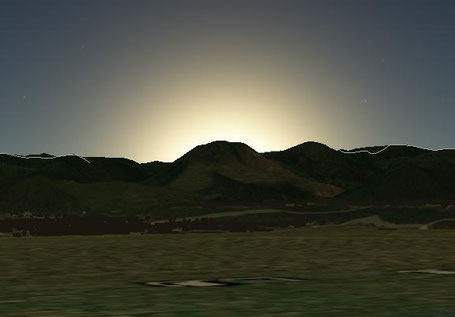
表紙写真:福岡県宗像市 沖ノ島の北極星 一の岳灯台、山頂を望む、撮影 山村善太郎

--------目次-----------
●巻頭言 上田晴彦
論文
●大湯環状列石の岩石配置図に関する検証 平津豊
Verification of rock layout of Oyu Stone Circles. (Yutaka HIRATSU)
●遺跡大湯環状列石の天体観測 柳原輝明
Astronomical observation of the Oyu Stone Circles. (Teruaki YANAGIHARA)
●岐阜県中津川市・恵那市・八百津町・川辺町・美濃加茂市・関市まで約48km・北緯35度31分40秒ライン上に並ぶ巨石ネットワークとは 小林由来(金山巨石群リサーチセンター代表)
What is the megalithic network on the 48 km long, 35 degrees 31 minutes 40 seconds north latitude, line through Nakatsugawa City, Ena City, Yaotsu Town, Kawabe Town, Minokamo City, Seki City, Gifu Prefecture? (Yoshiki KOBAYASHI) (Kanayama Megaliths Research Center)
●藤原京・新益京という「京の二重構造」(続報) 桜田和之
"Double structure of Jobo" called Fujiwara-kyo and Aramashi-kyo (Part 2) (Kazuyuki SAKURADA)
●周易八卦図に基づく前漢長安城の主軸線設定プラン 桜田和之
Major axes setting plan of Former Han Chang’an Castle based on the I Ching bagua (Kazuyuki SAKURADA)
●日本における考古天文学の現状と課題 北條芳隆
Current situation and issues of archaeoastronomy in Japan. (Yoshitaka HOJO)
テクニカルワンポイント
●地図の種類 平津豊
学会ニュース
●第1回 奈良県山添村・シンポジウム報告
学会誌 要約紹介 通巻3 2021年1巻1号
VOL3-1◆ 大湯環状列石の岩石配置図に関する検証 平津豊
Verification of rock layout of Oyu Stone Circles Yutaka HIRATSU

日本を代表するストーンサークルである大湯環状列石について、過去の報告書に書かれた岩石配置図の不備を指摘し、現時点で正しいと考えられる岩石配置図に紀元前2千年時点の二至二分の太陽の方位を書き込んだ図を提示した。そして、大湯環状列石は、夏至を意識して造られているとされているが、万座環状列石の中心と日時計状組み石を結ぶ線は、夏至の日の入り方向からずれていると考えられるため、この学説に再検討を求めた。
Regarding the Oyu Stone Circles, which is a representative stone circle in Japan, the author pointed out the deficiencies in the rock layouts depicted in past reports. Then, the author presented a map of the rock layout, which is believed to be correct at this time, with the orientation of the sun as of 2000 BC.
The Oyu Stone Circles are said to have been built with the summer solstice in mind.
However, the line connecting the center of the Manza Stone Circles and the sundial stone arrangement deviates from the direction of sunset at the summer solstice, so the author asked this theory to reconsider.
VOL3-2◆ 遺跡大湯環状列石の天体観測 柳原輝明
Astronomical observation of the Oyu Stone Circles Teruaki YANAGIHARA
遺跡大湯環状列石の一つの役割は天体観測であると言われている。遺跡の中にある日時計状組石から見た二至二分の太陽の出入りする地形を天文シミュレーションにより特定し、それが特徴的な地形であるかどうかを検証した。結果は、明らかに意図的な地形に太陽が出入りすることが確認できた。また、遺跡にある木柱列が星の観測装置と想定し、天文シミュレーションによりどの星を指しているかを検証した。結果、縄文人にとって重要な栗の収穫期をシリウスの夜明けの出現で予知していた可能性が明らかとなった。これらから、遺跡大湯環状列石が天体観測地であると言える。
It is said that one of the roles of the Oyu Stone Circles is an astronomical observation . The terrain in which the sun enters and exits as seen from the sundial stones in the ruins was identified by astronomical simulation, and it was verified whether it was a characteristic terrain. The results confirmed that the sun was clearly entering and exiting the intentional terrain. In addition, assuming that the colonnade at the ruins is a star observation device, we verified which star it points to by astronomical simulation. As a result, it became clear that the appearance of the dawn of Sirius might have predicted the harvest time of chestnuts, which is important for the Jomon people. From this, it can be said that the archaeological site Oyu Stone Circles is an astronomical observation site.
VOL3-3◆ 岐阜県中津川市・恵那市・八百津町・川辺町・美濃加茂市・関市まで約48km・北緯35度31分40秒ライン上に並ぶ巨石ネットワークとは小林由来
What is the megalithic network on the 48 km long, 35 degrees 31 minutes 40 seconds north latitude, line through Nakatsugawa City, Ena City, Yaotsu Town, Kawabe Town, Minokamo City, Seki City, Gifu Prefecture? Yoshiki KOBAYASHI

金山巨石群リサーチセンターでは、2018年から開始している中津川市の巨石群調査の拡張として、関市までの約48km圏内における巨石群調査を現在行っている。これまでに、北緯35度31分40秒の東西ライン上に、中津川市、恵那市、八百津町、川辺町、美濃加茂市、関市まで、少なくとも14ヵ所の巨石群を確認している。中でも関市坊地から西神野までの約2.5kmの範囲内に7ヵ所の巨石群があり、互いに見通せる間隔で巨石が並んでいる。これらの巨石群では、おもに春分や秋分の、昇るまたは沈む太陽の観測と、北極星を観測できる巨石構造がある。北極星観測から年代を推定すると、地球の歳差運動の影響により約4500年前のりゅう座のトゥバンが北極星として輝いていた時代が、ひとつの説として推定できる。つまり金山巨石群同様、縄文時代に遡る巨石天文観測台と考えられる。また考古学的背景から、約48kmの東西ライン上には、各地縄文遺跡の密集するエリアがあり、往来する古山道の東西ラインとも重なっている。これらの巨石群は、縄文時代、太陽と共に生きる人々の生活と深く関わり、各地の人々とのコミュニケーションを通し巨石ネットワークが構築されたものと考えることができる。
The Kanayama Megaliths Research Center is currently conducting an extension of the Nakatsugawa City megalith group survey that started in 2018. It extends the survey over a range of about 48 km to Seki City. So far, at least 14 megaliths have been confirmed on the east-west line at latitude 35 degrees 31 minutes 40 seconds north. The locations include Nakatsugawa City, Ena City, Yaotsu Town, Kawabe Town, Minokamo City, and Seki City. Among them, there are seven megaliths within a range of about 2.5 km from Seki City Bouji to Nishikamino, and the megaliths are lined up at intervals that allow them to be visible to each other. In these megalithic groups, there are mainly observations of the rising or setting sun in the spring and autumn equinoxes, and megalithic structures that can observe the North Star.Estimating the age from the observation of the North Star, one theory is based on the time when Thuban in Draco was shining as the North Star; it was about 4500 years ago due to the influence of the precession of the Earth. In other words, it can be thought of as a megalithic observatory dating back to the Jomon period, similar to the Kanayama megaliths. Also, from the archaeological background, the east-west line of about 48 km runs through the area where Jomon archaeological sites are concentrated, and it overlaps with the east-west line of the old mountain road. It can be considered that these megalithic groups were deeply connected to the people living with the sun during the Jomon period, and that a megalithic network was constructed through the communication of people in various places.
VOL3-4◆ 藤原京・新益京という「京の二重構造」(続報) 桜田和之
"Double structure of Jobo" called Fujiwara-kyo and Aramashi-kyo (Part 2) Kazuyuki SAKURADA

前稿では、藤原京の朱雀大路を復元することによって、持統朝期にできた藤原京と文武朝期にできた新益京という、中軸線の振れ角度の異なる二つの京が二重構造的に重なり合っており、藤原京の大極殿が新益京の朱雀門に造り変えられていたことを明らかにした。本稿では、四条大路を復元することで、西五坊大路が藤原京の西京極であることを明らかにした。その結果、二つの重なり合った京のそれぞれについての条坊規格が求まり、藤原京も新益京も南北九条、東西十坊に復元できる。藤原京の条坊に極めてよく似た都城は、新羅の金京である。藤原京の大極殿を新益京の朱雀門に置換するために、新益京は藤原京の条坊規格を2倍に拡張した都城となっている。四条大路においても、朱雀大路と同様に条坊の左旋現象が検出でき、飛鳥型「天の中軸線」の経時的な左旋現象を追認することができた。「宮内先行条坊」とよばれる条坊路に伴う側溝の多くは、藤原京が新益京へと拡張される慶雲元年(704年)から二年にかけて掘られたものである。
藤原京が新益京へと拡張され、藤原宮から新益宮への遷宮は慶雲二年四月であるが、その後もいっこうに災異は止まず、ヤマト朝廷は早くも同年六月には新益宮への遷宮の失敗を認めて、遷都の検討に入ったものとみられる。
In the previous paper, it was revealed that by restoring Suzaku-oji Street of Fujiwara-kyo, two Imperial capital cities with different deflection angles of the central axis, Fujiwara-kyo created in the period of Empress Jito and Aramashi-kyo created in the period of Emperor Monmu, overlapped in a two-layered structure, and Daigokuden in Fujiwara-kyo was transformed into Suzaku-mon Gate in Aramashi-kyo. In this paper, by restoring Shijo-oji Street, I clarified that Nishi-gobo Street was at the west end of Fujiwara-kyo. As a result, a Jobo standard was proposed for each of the two overlapping Kyo, and both Fujiwara-kyo and Aramashi-kyo were restored to nine Bo-districts through north to south, and ten Bo-districts through east to west. A capital city very similar to this is Kin-kyo in Silla. To replace Daigokuden of Fujiwara-kyo with Suzaku-mon Gate of Aramashi-kyo, Aramashi-kyo had a double-sized-Jobo standard compared to Fujiwara-kyo. On Shijo-oji Street, as on Suzaku-oji Street, the phenomenon of Jobo's leftward rotation can be detected, and it was possible to confirm the time-dependent leftward rotation of the Asuka type 'Celestial Central Axis'. Most of the gutter remnants of precedence Jobo inside of the Fujiwara Palace were dug during the period from 704 to 705, when Fujiwara-kyo was expanded to Aramashi-kyo.
The transfer of the Imperial palace from Fujiwara Palace to Aramashi Palace took place in April 705, but the calamity never stopped, and it seems that the Yamato Court had already admitted the failure of the relocation of the palace in June of the year, then started to consider transferring the capital.
VOL3-5◆ 周易八卦図に基づく前漢長安城の主軸線設定プラン 桜田和之
Major axes setting plan of Former Han Chang’an Castle based on the I Ching bagua Kazuyuki SAKURADA

前漢長安城には東西方向と南北方向という二本の主軸線が並存しており、それら主軸線は『周易』の文王八卦図に基づいて設定されている。東西方向の主軸線は、文王八卦図の震-兌ラインであり、春分日の日出のときの春分点(東)と秋分点(西)を結ぶ「天の中軸線」を地上に象ったものである。
高祖劉邦が漢を建国した高帝元年十月に五星聚井の瑞祥が出現したとされるが、このときの天象は地上に象られており、それは黄土台地上の天井岸村に残る天斉祠と五星基壇であって、五星基壇は帛書八卦図に基づいて配置されている。南北方向の主軸線は、五星基壇の水星壇を北端とし、南山の子午谷口を南端とする全長77kmの直線であって、途中で長陵の南中門と、長安城の南中門である安門を通過している。主軸線の北端が水星壇であることは、前漢王朝初期の皇徳が水徳であったことの証でもある。この主軸線は文王八卦図の坎-離ラインであり、それは高帝元年十月の日出直前に出現した「天の中軸線」(壁宿-天皇大帝-天頂-軫宿距星を通過)を地上に象ったものである。この「天の中軸線」は、天環(環状に見える天の川)の出現を伴っており、漢が王朝名に「漢」を用いたのはこれに因っている。さらにその時の北斗の形を地上に象ったものが長安城北壁となっており、同日の昼に太陽が南中するときの南斗(斗宿)の形を地上に象ったものが長安城南壁となっている。長安城が斗城とよばれた所以はここにある。
東西方向の「天の中軸線」は経時的には旋回しないが、南北方向の「天の中軸線」は歳差効果によって経時的に左旋する特性を有している。長安城の南北方向主軸線は北で東に0.0914°振れており、前177年の南北方向「天の中軸線」のそれと一致している。南北方向主軸線が設定されたのは、実際には高帝八年(前201年)であったと見られ、漢は24年後の「天の中軸線」を用いて都城の南北方向主軸線を設定していたことになる。よって前漢時代には「基準年」を用いる方式がすでに導入されていたのである。
The two main axes, the east-west and the north-south direction, coexist in Chang'an Castle in the Former Han, and these main axes are set based on the King Wen bagua diagram. The major axis in the east-west direction is the Zhen-Dui line in the diagram, which depicts the Celestial Central Axis connecting the vernal equinox (east) and the autumnal equinox (west) at the sunrise on the vernal equinox on the ground.
When Gaozu Liu Bang founded Han, it is said that the auspicious omen of five planets gathered at the Well mansion appeared in October of the first year of Emperor Gao's reign. The celestial phenomena at that time were pictured on the ground, and they were the Tianqi Shrine and the five planet-stylobates remaining on the Tianjing'an village on the Loess Plateau. The five planet-stylobates were arranged based on the Silk Texts bagua. The major axis in the north-south direction is a straight line with a total length of 77 km starting at the Mercury stylobate and ending at the Meridian Valley south end in Nanshan, passing through the South Gate of Changling and the South Gate of Chang'an Castle along the way. The northern end of the main axis is the Mercury stylobate, which proves that the Virtue of the early Former Han dynasty was the Water phase of the Wuxing. This major axis is the Kan-Li line in the King Wen bagua, which depicts the Celestial Central Axis connecting the Wall mansion, the Tenno Taitei(天皇大帝), the Zenith and the determinative star of the Chariot mansion that appeared just before the sunrise in October of the first year of Emperor Gao's reign on the ground. The Celestial Central Axis was accompanied by the appearance of the Celestial Circle (the Milky Way which looks like a circle), which is why Han used 'Han(漢)' as the name of the dynasty. In addition, the shape of the north wall of the castle was modeled after the shape of the Big Dipper at that time, and the shape of the south wall of the castle was modeled after the Milk Dipper(i.e. the Dipper mansion), which was the place where the sun was moving south in the daytime. This is why Chang’an Castle was called the Dipper Castle(斗城).
The Celestial Central Axis in the east-west direction does not rotate with time, but the Celestial Central Axis in the north-south direction rotates to the left with time due to the Axial precession effect. The deflection angle of the major axis in the north-south direction at Chang’an Castle is +0.0914 degrees, which corresponds to the angle of the Celestial Central Axis in the north-south direction in 177 B.C. It is considered that the north-south axis was actually set in 201 B.C., which means that Han used the Celestial Central Axis 24 years later to set the north-south axis of the Castle. Therefore, it is considered that the procedure of the Scheduled Year was already introduced in the Former Han period.
VOL3-6◆ [寄稿]日本における考古天文学の現状と課題 北條芳隆(東海大学教授)
Current situation and issues of archaeoastronomy in Japan Yoshitaka HOJO

私たちが2019年4月から共同で研究を進めている考古天文学とは、文字を残さなかった先史時代遺跡の性格について、同時代の天体運行を再現しつつ考察しようとするものである。
周辺景観との関係を見据えながら遺跡の性格を考えることの重要性については、日本考古学や古代史学でも次第に共通認識となりつつある。そこに天体景観を加えれば、周辺景観は静止した情景にとどまることなく、動的で回帰的な様相を帯びる対象として捉えられる。
このような過去の全体景観の再現が可能であれば、祭祀や埋葬に関連した遺構の評価に革新的な進展が期待できる。太陽や月の出没が信仰の対象であった可能性も高く、祭礼の期日を具体的に把握することも可能である。また『古事記』や『日本書紀』(以下記紀)などの古記録には、太陽や月を神格化する営みが確認できる。考古天文学の手法を応用すれば、祭祀関連遺跡の実態に引きつけながら、天体を神格化する営みの背景を推察することも可能になる。もとより暦の問題とも絡めた分析も期待される。
上記の課題設定に沿って、2019年4月には科学研究費の助成を受け「考古天文学会議」を立ち上げた。きっかけは拙著『古墳の方位と太陽』と後藤明氏の著作『天文の考古学』が共に2017年5月に同成社から刊行されたことであった。後藤氏は天文学の知見を援用した文化人類学・考古学の構築を目指していたので、両著の刊行を機に意見交換をする機会に恵まれ、相互の基本認識で一致した。後藤氏を介して国立天文台に所属する関口和寛氏や高田裕行氏など天文学関係者との連携が実現することになった。
さらに『歴史のなかの大地動乱−奈良・平安の地震と天皇−』(岩波新書、2012年刊)の著者でもある保立道久氏と私は、景観史学の共同研究を進めてきたこともあり、今回の課題設定もその延長線上にあった。ただちに天文現象への関心を抱く文献史学者への打診がおこなわれ、現在の研究体制が構築されたのである。私の目からみても異色のメンバー構成だと思う。
ちなみに「考古天文学」は後藤氏の提案に沿った命名である。以前に斉藤国治が提唱した「古天文学」とも響き合う。なお、貴学会が先行して設立されたこともあり、新たな名称が求められたという背景もある。
なお日本考古学界の現状をみれば、過去の天体景観に学問的な関心が向けられる情勢だとは言いがたい。というより、まだ拒絶的な態度が堅持される段階だとみるべきであろう。戦後の日本考古学や古代史学がたどった研究動向と深く連動しているからである。
考古学については、皇国史観からの脱却すなわち記紀神話との決別が主要な命題となり、虚構を排して科学的な研究法を構築する必要があった。そのさい重視されたのはマルクス主義的な史的唯物論であった。社会は生産や経済活動(これを下部構造と呼ぶ)がベースとなり、祭祀や政治(これを上部構造と呼ぶ)はそれに規定され、社会構造は生産様式として把握される、といった理論的な枠組みである。この理論に依拠すると、天体景観への認知や信仰は、観念領域に属する上部構造の問題とみなされる。だから重視すべき下部構造つまり生産や経済とは切り離され、棚上げされたのである。上部構造のなかで最重要視されたのも支配体制の問題であった。
ただし、そのような模索期間も終了しつつあり、現在は新たな局面への移行期にさしかかっている。景観史への認知度が高まってきたからであり、観念領域で生じた変革が社会に与えた影響の強さにも学界全体が気づき始めたからである。
さらにGPSの技術的な発展は、天体景観を含む全体景観を的確に再現することを可能にし、新たな研究環境を用意してくれている。この環境を活かさない手はない。考古天文学会議は、このような現状認識に立脚するものである。
現在はもう1件の科学研究費助成金を原資に、関口氏の主導のもと、science Nodeの岩城邦典氏が技術部門を担当するかたちで、各地・各時代の遺跡・遺構からみた過去の全体景観を再現するシミュレーション・システム〈arc Astro VR〉が構築されつつある。本システムはほぼ完成の域に達しており、日本語と英語のマニュアルを添えて2022年度上半期には国立天文台から無料で公開される予定である。
吉野ヶ里歴史公園を会場に開催された第4回考古天文学会議では、そのお披露目を兼ねたデモンストレーション映像を開示した。次回の世界考古学会議では後藤氏がプレゼンをおこなう予定である。
では2019年以降に解明された研究成果の一端を紹介する。2017年の拙著では太陽の運行と北天の周回星(現在の北極星「鉤陳」や北斗七星の運行)を問題にしたが、現在は月の問題に重点を移している。そこで地上からみた月の運行の特徴や太陽の運行との関係を解説することから始めたい。また研究の経緯についても記述する。